Introduction
The lockdown of 2021 thwarted everyone's summer trekking plans and kicked all our bucket list items onto next years calendar. I was feeling particularly glum as I couldn't relish the goodness of deep water pools in the scorching Andhra sun at my favourite destination in the Eastern Ghats, Nagala. But all was not lost! By the time the lockdown was lifted, the rains had moved inwards to the South and it had already been pouring for the past couple of weeks in the city. So I decided to make the most of it and do a short hike up one of the dozen hillocks bordering the city of Bengaluru.
Bananthimari betta
Welcome to Bananthimari betta, a multi-tiered hill located just 60 Kilometers from
Bangalore in the Ramanagara cluster of hills. Bananthimari is actually comprised of two hills which can be accessed separately. It is interspersed with farms, rocky patches, and lush green valleys in between. It is 2000 ft in height, and yes, you can breathe in some clouds at the peak during the monsoons. We were amazed to find even a stream flowing through it somewhere during the ascent, but I suppose it is a seasonal one that comes to life only during the monsoons. I was amazed and awestruck as I stood atop the main peak, and gazed down into the valley below.
There was just too much to explore! I, for one, would definitely need to
visit this place at least a dozen more times to explore it in its entirety, and for my brain to form a complete mental image of the area.
It was the second weekend which had been unlocked post the actual unlocking of the city, and I was itching to get back to my usual trekking routine. In fact, I had initially succeeded in putting a group together for a proper two day trek to a reserved forest. But as luck would have it, that trek got cancelled and I ended up going to Bananthimari betta with another bunch of friends. I was a bit hesitant and skeptical of the place at first. But the moment I saw the mist flowing off the top of the peak in the distance as our car wound its way to the hill, all my apprehensions about the place (being too less of a trek) faded away. This hill is by far, unlike any of the other peaks I've scaled close to the city, and one of the few that resembles a deep reserved forest in the Western ghats, complete with thick dense foliage, a bamboo forest, a stream and a cold misty peak with multiple viewpoints. What more does one need for an exploratory mission?
First half
With that being said, BM Betta is great for beginners, expert trekkers, and everyone in between. The trail is pretty straightforward once you catch it at the base, and the scenery keeps changing as you go up. The trek initially begins with a jeep trail which gradually narrows down to a thin shepherd trail. We began our trek some time around 730, with our packed breakfasts in our backpacks. Somewhere during this shepherd trail portion of the trek, I heard a peacock fly overhead but before I could turn to take a look, it had disappeared. Nevertheless, we kept hearing peacock calls all through the shepherds trail section of the hill. After you've done hiking through the more open sections, with shrubbery farther from you on either side, you'll arrive at a point where you'll need to make a decision on which hill you'd like to climb. Like I said in the beginning, there are multiple peaks here with many access points. We decided to climb the one to our left, since our leader informed us that it was the "main" peak. After getting off the shepherd trail, we were enshrouded by a massive bamboo grove with barely any noticeable trail to follow.
We had our breakfast by this colourful water body with the wind making ripples on the surface of the water, scattering the reflected dark green of the surrounding shrubbery all around the pond:
 |
| Misty hill in the background - a perfect view for breakfast |
 |
| Wind sending ripples through the water |
It was all up to the trek leader now to carve the path out for the rest of us who were new to the place. With tall bamboo shoots towering over us to form a thick canopy overhead and fallen branches scattered all over the place, we had to literally bushwhack our way to the opening at the top. We ran into spiderwebs, thorns, wet leaves, and other organic matter, all while holding onto slippery tree trunks and branches for support. I think the bamboo grove provided a moist and humid environment for fungi to grow and so we were in for a visual spectacle of sorts; wild mushrooms of varying colours, shapes, and sizes, and the miniature organic matter growing in the boscage.


Whether there's an actual trail here that's been overrun with shrubbery due to lockdown induced abandonment, or this section was always wild, untouched, and blanketed in thick foliage is anyone's guess. But none of that mattered! As the rush of adventure we got navigating this steep section, getting on all fours, squatting under big logs, pushing thorny branches out of the way, climbing over fallen logs, sometimes jumping over them, and craning our necks to see further ahead in the brush, the dull monotonous trail from earlier in the morning totally paled in comparison. The heavily forested section didn't go for long, and by no time we arrived at a clearing. It opened up to scintillating panoramic views of surrounding peaks, evergreen forest, and countryside farms, with heavy, grey monsoon clouds providing the background score. The clouds were far on the horizon, and luckily didn't obscure our view of all the wonderful sights that lay right below us.
 |
| The viewpoint after the bamboo section |
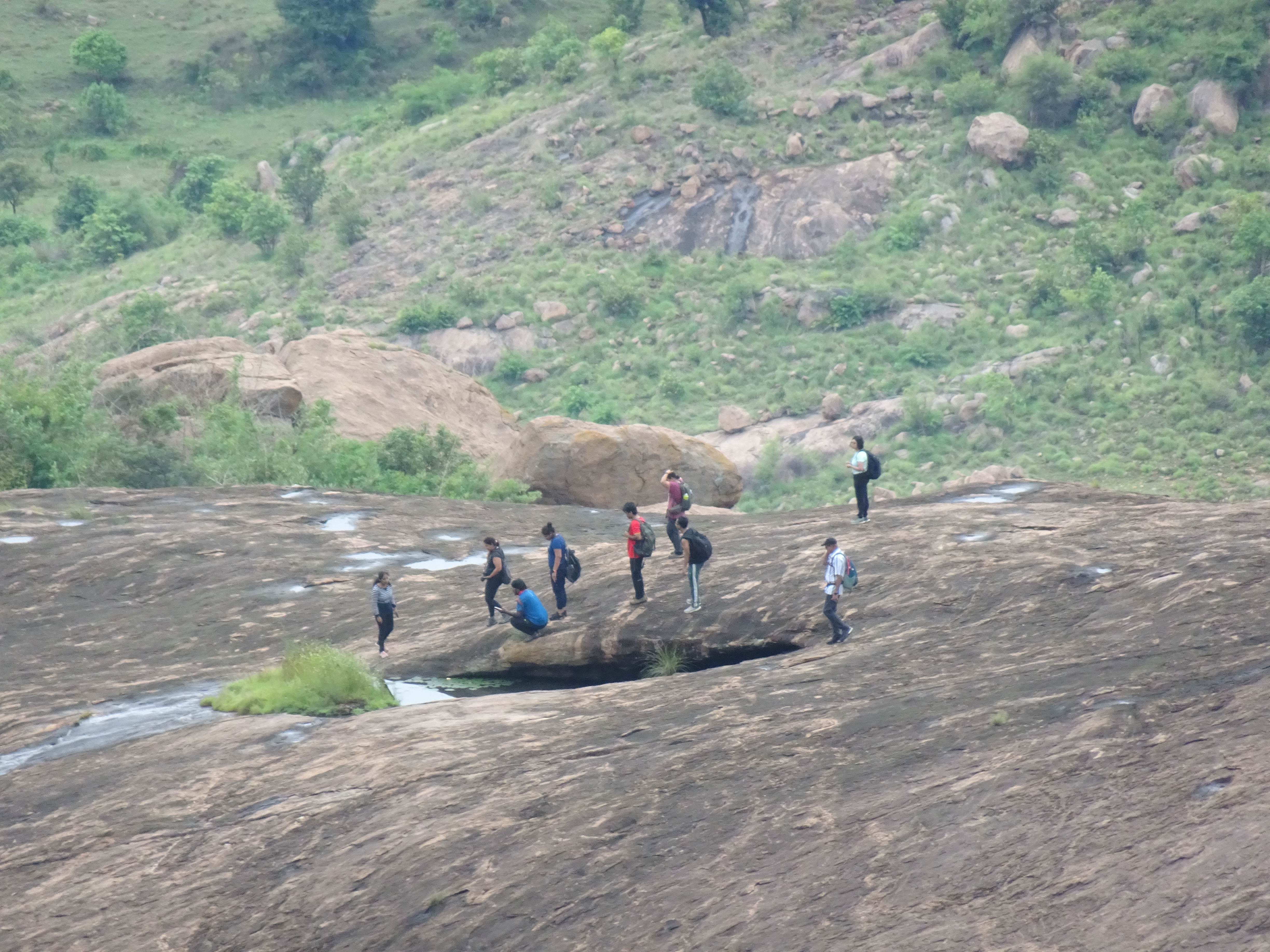
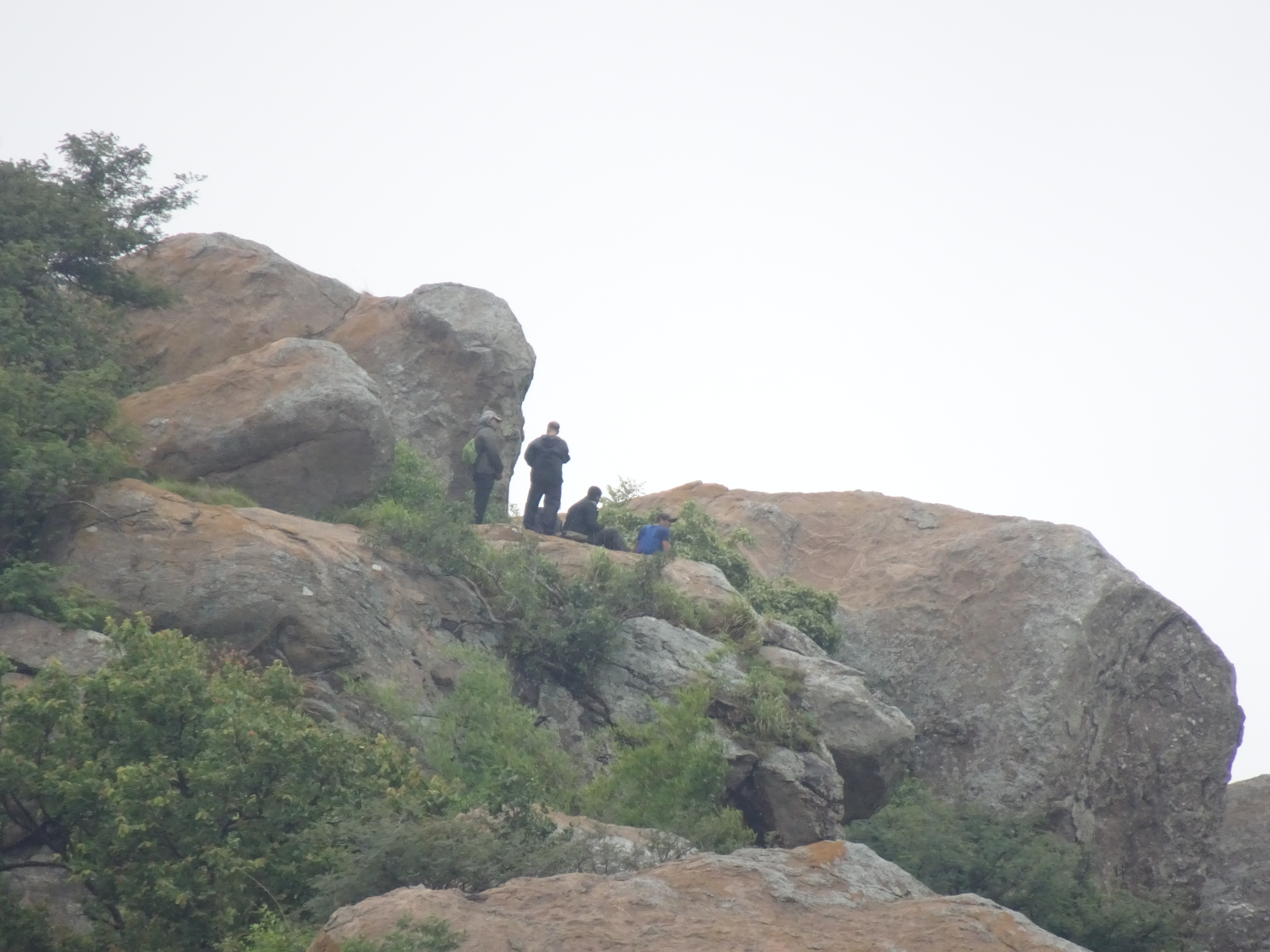
Together, we heaved a huge sigh of relief on completing the forested section, and I went ahead to rest my feet at a huge flat boulder. A carpet of green was glittering with life in the thick forest below, and the entire valley sparkled with the new lease of life bestowed upon it by the monsoon. While taking in all these amazing sights, we noticed another group on the adjacent hill that was right in front of us, maybe around 700 metres away or so. The same hill which we would have reached had we gone straight instead of taking a left on the trail. The group consisted of about 20 people or so, as much as we could establish from such a distance.
 |
| The group on the other side. Notice the water trickling down |


 |
| The group huddled around a pond |

The Second half
After relishing the cool suburban breeze effused with the rich fragrance of fertile forest soil, we decided to proceed for the peak. The route was such that we had to take a left U-turn to go around the hill as we couldn't continue straight. That route was rendered impassable by the steep rock face with a drop to the right. We had two choices from here. To either proceed on the steep but slippery hillside and reach the other side quickly. Or take an alternative route; backtrack our way a few meters down, and then climb up again using the dense foliage as gripping points, which would be a bit more time consuming. Two of our team members took the first option and two took the other.
The first option involved precariously walking across the stony hill face, which slanted at a perilous 70 degree angle, with no trees or grass to hold on to and water trickling down at some points. They decided to do the section barefoot, and took it one step at a time. In fact, the third trekker and I stood frozen in our places waiting with baited breath as the other two laboriously made it across to the other side. Only when they successfully reached the other side, and were back on firm footing, did we heave a sigh of relief and began moving.

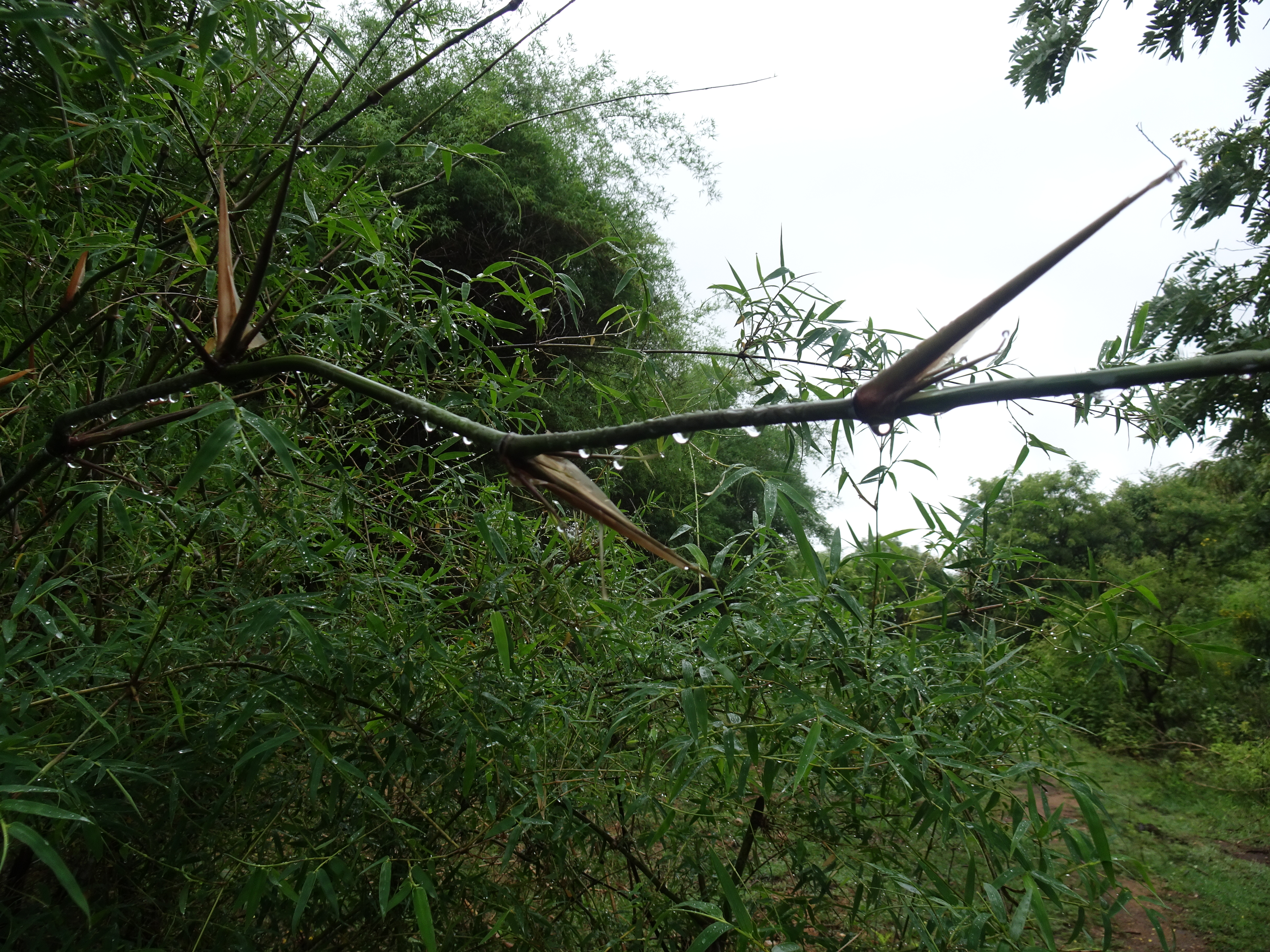

I wish I did, but I've not taken any photos of this particular section, mainly because I was too busy finding a handhold and plonking myself up on the rocks correctly. This section was completely wild and untouched. The boulders were far from each other, they were covered in shrubs, and you wouldn't know if your foot would land on solid ground or just fall through the foliage in between. So we had to take it very carefully one foot at a time. We had to again resort to rock climbing, and propping ourselves up on massive boulders, as well as shaky wooden logs, to get higher and higher. All while pushing thick branches out of our faces in order to see further ahead. Finally, we arrived at a section that resembled a trail but which was heavily overgrown owing to weeks of continuous rain.
There was another slippery rock face that we had to climb, but it was easier compared to the first one. Once we arrived at the peak, we were engulfed by a chill breeze that was constant more or less the entire time we were there. There were freshwater ponds which had formed due to the rain, and I got down on all fours to lap it up animal style. The breeze felt colder than it actually was due to the sweat that had formed on the surface my skin. That is a most wonderful feeling that cannot be described. It isn't that menacing kind of cold which makes you run for your warmers, but the soft, affectionate kind that people love and generally prefer. The one that adds to the ambiance and brings out the winter mood everywhere.
The clouds kept dreamily passing by one after another, sometimes right through us, and sometimes a few meters below the peak like a carpet. We lazily sat down on the ground and took in the sights of the entire landscape ahead of us which also comprised of several peaks in the distance. Some of us decided to balance their phones between two rocks in order to capture time lapse videos of cloud movement during the break. After being sufficiently rested, we went to check out the opposite side of the hill, the direction which we came from, and then continued with our descent from there. During the descent, we could still see the gang on the opposite hill. I think that flat piece of rock was their final destination. There were some people on the peak of that hill as well, but we doubted it as to whether they could have been part of the same group.
 |
| Completely covered in fog |
I put the 30x digital zoom on my new camera to the test and tried to capture them to the finest level possible. Here's how that turned out:

The Real Adventure
They could have been a subset of the very same group that was resting near the pond. That does happen a lot in trekking. One set of people who want to do the more difficult part of something, while the rest wait for them at another point lower or earlier on the trail. We ran into the group by pond, as we ourselves arrived at that spot while descending. Yes, they were still there! We took that route while descending instead of just tracing back our steps via the same route we used to ascend the hill. We love exploring that way. And an exploration it was indeed!
We later arrived at a point where the hill rolled down steeply, there was barely any vegetation, and every step had to be intentional and calculated. Little did I know that the real adventure of the day quietly lie in wait for me towards the very end of the trek. There were trickles of water washing over the rocks in intervals and you wouldn't want to step on them. I got separated from the group as I wasn't confident of going down the same way. My quest to find and land myself on only the driest patches of rock took me far to the right and I was stuck between a rock and a hard place. Towards my left, water. Towards my right, water. Right in front of me water.
Now the only option I had was to climb back up and find another way around the wet patch which ended up taking me ever further away from the group, leaving me to find my own exit to the plains from the right side. It didn't take even a few minutes and I had successfully got down to ground level after dodging all the wet portions.
But everyone had gotten down on the left and I now had to rejoin them.
I kept my eyes glued to the ground in the hopes of spotting a shepherds trail or anything of the sort that would take me to the left side. I found it after hiking for a while and joined the trek leader waiting there. Somehow, I had made it before the three of them could make it down together. And all along I was assuming that they'd already reached, and would be waiting for me there.

 |
| Appetizing mushrooms on the way down - but are they edible? |

The ride back home was pretty uneventful, except for the fact that we stopped at a really horrible place for lunch. The food didn't taste bad. It's just that there wasn't any taste at all! 😁 We asked for extra salt and somehow made it through meal. If one can make it through that last steep section of the hill, one can make it through anything, we declared in unison. And besides, most food tastes good after a trek no matter how bad it is. All you want to do is fill your tummy.
We got back to my friend's house where I had parked my bike. It was dark and cloudy in the city, just as it had been all day long. I picked it up and started for home. It was around 530 in the evening and the city traffic was just starting to pick up. Luckily, it wasn't raining unlike earlier in the morning, when I got drenched getting there. It was still cold though, and the effect was magnified for me as my trekking singlet was still wet, and I had worn mornings jacket (which hadn't dried one bit in the car) over it.
Unmistakably, this is one of the most wondrous parts of short single day hikes near the city that I treasure the most. Riding back in the pouring rain soaked to the bone, shivering continuously as you make your way through slushy roads and clogged intersections. That homely warmth and relaxation you feel on getting home and snuggling into a blanket with some hot food and a movie. Now just imagine if I had taken a cab instead.
I would have missed out on all these abstract fantasies, plus so much more!